Group: Summit Good
Meet time: 9.15am
Start time: 9.30am
Estimated finish time: 3pm to 3.30pm
Distance: 7.3 miles (11.74 kilometres)
Ascent: About 2720 feet (829 meters)
Ramblers walk grading: A (Strenuous)
Start point: The Bait Cabin Café (on the top of Honister Pass)
Postcode: CA12 5XN
Car parking: There are two car parks on the top of Honister Pass, while on the eastern side there are a few small lay-bys which you can use for parking if you get there really, really early.
It is the responsibility of each walker to make sure they understand where to park. If you are not sure where the car parking/meeting point is, you must contact the walk leader at the latest the day before the walk. You should not rely on mobile phones or postcodes. There is often no mobile reception near walk meeting points and postcodes are for the nearest place nearby but should only serve as a guideline. Please allow plenty of time to find a parking space so that walks can start promptly.
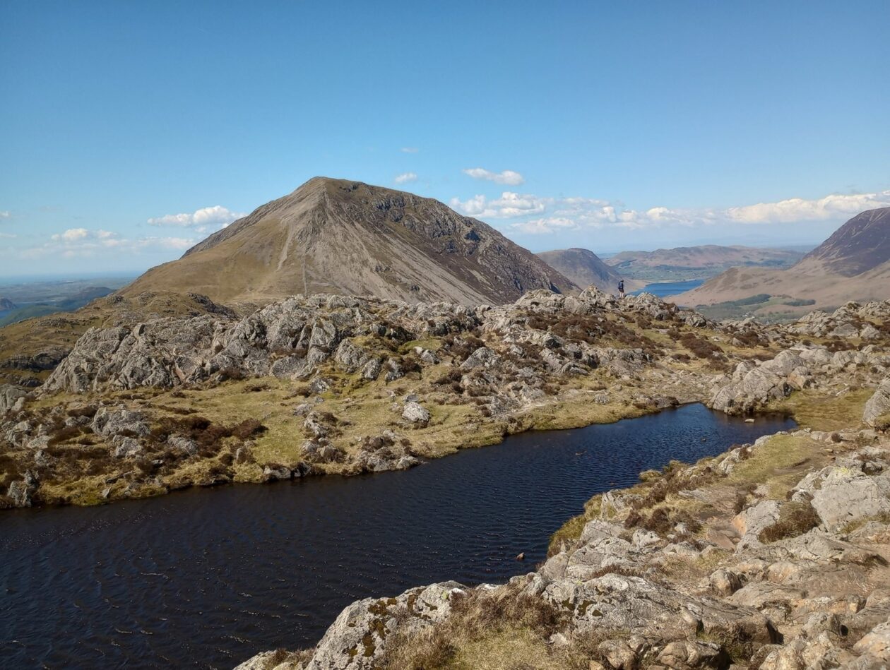
Description: Another linear walk and this route being another I am very familiar with. It starts from Honister Pass and it is an immediate ascent (one of several on this walk) as we take the path to reach the old tramway. Once at the top we come to a small plateau and – weather permitting – the whole area opens up as the mountains of the route reveal themselves.
Dominating the scene are Haystacks and behind that the much taller Pillar, but before we get to Haystacks we have to dip down and cross the stream that is Warnscale Beck, after that point we enter the heathery territory of Haystacks which is full of crags and bodies of water. There are loads of hidden areas and two notable tarns, one of which we directly pass which is Innominate Tarn. The path veers back and forth towards the mighty northern rock faces of Haystacks, but never quite reaches them (fortunately for us); and this is a subtle ascent.
Now the top of Haystacks is the western point of this mini mountain range coming in at 597 meters. It looks straight down at both Buttermere and the upper half of Ennerdale; and for good reason is it a popular mountain amongst walkers.
We then have to dip down again to reach Scarth Gap Pass, the gateway between Buttermere and Ennerdale, and we then begin a third ascent to a prominent point called Seat (561 meters). Few go there as most focus on Haystacks, or one of the valleys, or High Crag. But I always go to Seat purely because of the view of Pillar and Ennerdale Forest. Also, from Seat one comes face-to-face with the imposing southern side of High Crag.
Thus begins the fourth ascent, the highest and hardest of them all, up High Crag as a snaking path through the grass makes way for steep gruelling scree slopes. But once at High Crag (744 meters) the true beauty of the western Buttermere mountains shows itself with the eye drawn to Pillar, or to the distant west, or to the table-top appearance of High Stile, or, to those who are not squeamish, to the great sheer eastern cliffs that each of the three western Buttermere mountains have.
The next part of the walk is a ridge walk with the eastern side being a sheer drop, though the path doesn’t get too close, to get to High Stile which is the highest mountain of the walk coming in at 806 / 807 meters. Predictably arguments will arise as people justify which peak of High Stile is highest: the eastern one or the western one. For those who are bagging Wainwrights be sure to go to both!
After High Stile there is another ridge walk where again the sheer drops are to the east, but the path keeps a certain distance from such perils. This brings us to the last mountain of the walk: Red Pike (755 meters). From this route Red Pike has perhaps the best vantage point of Ennerdale, while the northern view of Crummock Water and Grasmoor is always fantastic; and the beady-eyed may spy a sliver of Keswick and Threlkeld poking above Newland Hause.
Usually the final descent is a bit of a dull aware, but not so with this walk as first we come to Bleaberry Tarn, then the next descent shows Buttermere and the distant Fleetwith Pike until at last the stony-stepped path enters the woods. Just before we come to the village of Buttermere, there is of course the classic view upon the small field with a row of trees and Buttermere, Fleetwith Pike and Haystacks in the background. Finally the walk comes to an end at Buttermere Village.
This may sound like a long walk, but it is quicker and easier than one might expect- and starting from Honister Pass definitely helps!
This is a linear walk so most of us will park up at Honister Pass, while a few of us will park at Buttermere Village. Then, once the walk is done those parked at Buttermere Village will drive everyone else back to their cars in Honister Pass.
Please contact Miles on 07842 783319 by 10pm on Friday 2 February if you are coming on this walk (text or phone, or message on Facebook (Miles Saunders-Priem)). This walk is suitable for dogs as there are not too many sheep milling around the Howgills.
Please check the weather and bring appropriate clothing (waterproofs and spare warm clothing), footwear and enough food and water. The leader reserves the right to turn away any walker not suitably equipped. The leader may cancel the walk or modify the route dependent on conditions.
Car sharing is now possible – please contact the walk leader to arrange.
New members: please note the walk leader may ask for more information about your walking experience. This is to ensure you have the fitness required to complete the walk that is planned safely.