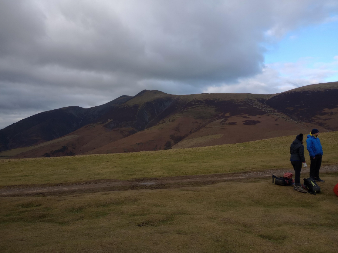
Walk title: Skiddaw and Longside Edge
Group: Summit Good
Meet time: 9.15am
Start time: 9.30am
Estimated finish time: 2.30pm to 3pm
Distance: 7.01 miles (11.28 kilometres)
Ascent: About 2600 feet (792 meters)
Ramblers walk grading: A (Strenuous)
Start point: Latrigg Car Park- which is where the road ends
Car parking: This is a popular car park for beginning walks up to Skiddaw. I would recommend parking there before 9am- especially if it is a sunny or dry day.
It is the responsibility of each walker to make sure they understand where to park. If you are not sure where the car parking/meeting point is, you must contact the walk leader at the latest the day before the walk. You should not rely on mobile phones or postcodes. There is often no mobile reception near walk meeting points and postcodes are for the nearest place nearby but should only serve as a guideline. Please allow plenty of time to find a parking space so that walks can start promptly.
*****UPDATE*******
Due to parts of the A591 being closed it is not feasible nor timely for a linear route. We will still go to Skiddaw but we will be returning to the start point. To add some variety on the way back I have decided to include Lonscale Fell and Latrigg as part of this walk. The total ascent and the time will be very similar.
Description: This is another linear route I have done at least five times. It begins from Latrigg Car Park and goes up the tourist trail to approach Skiddaw. This is a straight-up ascent of about 1000+ feet which mercifully bends around at places. When it levels out this is when the walk gets really good.
Normally people keep following the track to Skiddaw and miss out entirely Little Man. But I have a soft spot for Little Man, so I always take the grassy trod for the twin-peaks of Little Man (865 meters). It makes little difference to the walk time, but it offers one hell of a vantage point in the approach to Skiddaw. Though overlooked it is the second highest mountain in the Skiddaw Massif.
There is a small descent from Little Man as the route goes across a flat grassy patch divided by a fence. This brings us to one last main ascent but it’s only a few hundred feet and before you know we have come to Skiddaw. Now Skiddaw is actually three rolling peaks all above 3000 feet, and the highest one is the one to the north coming in 931 meters. On a clear day Skiddaw makes everything around it look small.
After Skiddaw a long gradual descent begins as we take a path going away from the second (and middle) peak of Skiddaw to go the loose and slippery gravel path which goes to Carl Side (746 meters). For the sake of those collecting Wainwrights we will make a very brief diversion to the top of Carl Side, but it’s another great mountain and it has a direct line of sight to Longside Edge which is an amazing ridgeline to descend.
Though ridge-like, Longside Edge is generously wide and has only one short section of scrambling. It also contains two Wainwrights: LongsideEdge (734 meters) and Ullock Pike (690 meters). This is the dramatic section of the ridgeline as it ever so slightly descends (heading northwards), but it’s when we leave Ullock Pike where it becomes clear that we have left the high terrain.
The immediate descent from Ullock Pike is steep, windy and has one small section of scramble, but it is short and the descent levels out as the ridgeline becomes a tongue and a small series of rolling hills.
Just when the walk becomes a little anti-climatic our desired path suddenly veers around leftwards and goes in a southwards direction towards woodland. Now Bassenthwaite and Whinlatter Forest dominate the view while we see the other side of Longside Edge to our left.
Soon the path enters the woodland and for a mile we follow a series of paths and forest tracks to reach the end point of Dodd Wood car park. Which conveniently has a café!
Don’t forget, after the walk Summit Good is celebrating their Christmas Meal at Woodstone Flame Grill and Pizzeria!
BONUS: This mountain is for the diehards and would probably add 30 to 45 minutes to the walk but nothing to the ascent. Close to the top of the tourist trail ascent, but before it levels out, there is a path that goes a bit right and runs parallel to a beck. When the path levels out it comes to the top of a grassy tongue, to the left is the top of the Skiddaw Range and to the right is Lonscale Fell (715 meters)- an easy stroll to reach. Lonscale Fell is perhaps the most interesting vantage point of them all in the Skiddaw Range. But I shall let the group decide about this one!
***
So how does this linear walk work for cars? There will be cars parked at the start point and at the end point, most will park at the start point of Latrigg Car Park, some will park at Dodd Wood Car Park.
I will ask a few people (who have told me they are joining this walk) if they can meet first at Dodd Wood Car Park by or before 9am. These people will be driven over to the start point to ensure everything is in place. It takes about 10 to 15 minutes driving between the two car parks, so it is a short road trip.
***
Please contact Miles on 07842 783319 by 10pm on Friday 8 Decemberif you are coming on this walk (text or phone, or message on Facebook (Miles Saunders-Priem)). This walk is suitable for dogs though they will need to be on the lead on Longside Edge. There are sheep dotted around Carl Side, Longside Edge and the adjacent lower moorland.
Please check the weather and bring appropriate clothing (waterproofs and spare warm clothing), footwear and enough food and water. The leader reserves the right to turn away any walker not suitably equipped. The leader may cancel the walk or modify the route dependent on conditions.
Car sharing is now possible – please contact the walk leader to arrange.
New members: please note the walk leader may ask for more information about your walking experience. This is to ensure you have the fitness required to complete the walk that is planned safely.